


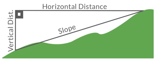
What is slope?
Slope is the measurement of rise or fall on any given land surface.1
Insurance companies and agents use slope calculations to price their policies accurately. Because buildings constructed on land that has a larger slope have increased exposure to risks such as landslides, earthquakes, floods, and wind, policies written for these types of properties are much higher than for properties with a smaller slope.
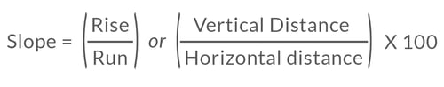
In numerical terms, slope is represented mathematically by the equation of rise (the vertical distance) over run (the horizontal distance) with the resulting calculation often converted to a percentage.2
Here is an example of a simple slope calculation:
A piece of land is measured and found to have a rise of 8 feet over a horizontal distance of 100 feet.
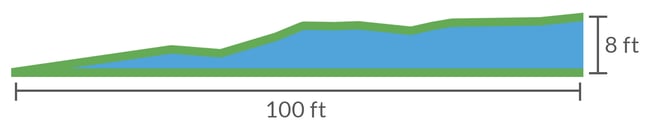
The gathered measurements are plugged into the slope equation.  The result indicates that the property has a slope of 8%.
Slope is a simple concept on paper, but determining it in the real world is a different matter. There currently exist several methods for calculating slope.3 As we explore each method, you will begin to understand that all current options are either labor-intensive or imprecise.
 Determining the slope of a property is key to accurately pricing a policy.
Related:
The Effects of Soil Type on Earthquake Damage
Methods of determining slope
Topographic maps:
Maps that display the earth's topography offer a two-dimensional representation of geographic elevation changes.4 Topographic maps indicate the shape of the land as well as critical geographic formations such as bodies of water. Comprised of contour lines, topographic maps show the elevation above sea level of various points in relation to one another.
Using this type of map, slope can be estimated by locating a given property, observing the indicated elevation changes, and calculating the resulting slope. Overall, this method produces a relatively accurate result.
However, this method does require knowledge of how to accurately read the map, a skill which, following the advent of newer mapping technologies, has become increasingly uncommon.
Hire a surveyor:
Though it may be expensive to do, surveyors can accurately determine the slope of a property by conducting an assessment using highly tuned tools.5
However, this method is not feasible for companies or agents who write many policies - the prohibitive price makes this method extremely impractical.
Do-it-yourself:
All that is required is a couple of wooden stakes, a long rope, a bubble level and some time. Here is the equation for calculating slope with this do-it-yourself method:
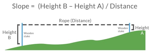
Even though it may be easy to calculate the slope for a property using this method, it takes time and is hard to replicate on a large scale. Just like hiring a surveyor, this method is not feasible for companies and agents who write many policies.
Eyeballing it
Thanks to the advent of mapping tools like Google Maps, determining rough estimations of slope can be achieved with minimal effort. By utilizing street view and observing hilly areas, underwriters can get a general idea of the slope of an area and factor their observations into pricing policies.
In contrast with the previous three methods of obtaining slope data, this method is the quickest but most imprecise, offering little more than a ballpark evaluation of an area's slope.
The future of slope calculations
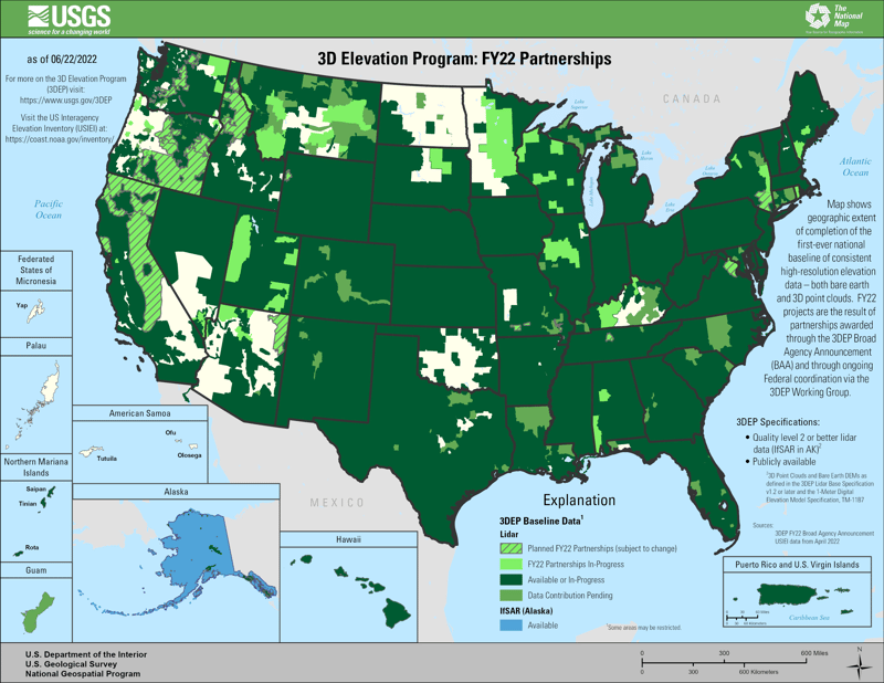
In 2016, the United States Geological Survey (USGS) began its first full year collecting data for a new program dubbed 3DEP.
3DEP, or the 3D Elevation Program, was initiated in response to the growing need for high-quality topographic data by a variety of agencies, governments, and companies. In order to collect topographic data, the USGS has utilized Lidar and IfSAR technology to collect extremely accurate elevation info.
Here is a map that indicates the total amount of data collected as of 6/22/2022 (this dataset will continue to expand as more areas are surveyed):

The capability to pinpoint elevation data for a specific area is now available to the public for the first time. Thanks to the expanding 3DEP elevation dataset, which includes information regarding buildings and structures, determining the slope of a specific area can now be determined easier and with a high degree of accuracy - all that's required is to match a given property to the Lidar map blueprint.
Here is an example of what a Lidar elevation map looks like:
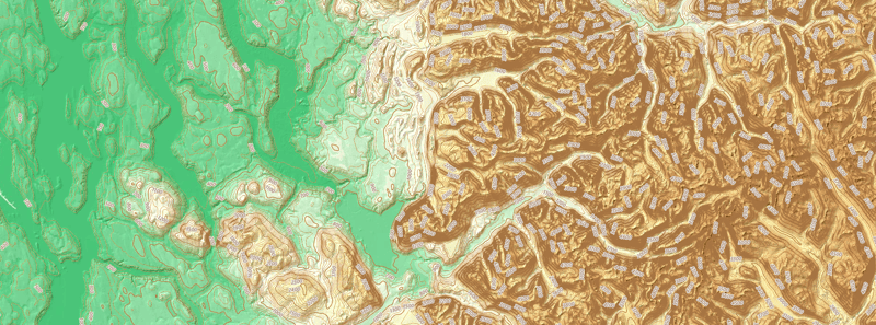
The resulting geospatial data gathered by 3DEP produces a detailed, precise, and interactive topographical map that can be utilized for a variety of purposes. In our case, we have created a slope look-up tool that harnesses the 3DEP data, giving insurance companies and agents the unparalleled ability to gain total topographical knowledge of any property.

[1] UT, https://extension.tennessee.edu/MasterGardener/CommunicationArchive/
[2] RVS Land Surveyors, https://www.rvslandsurveyors.com/how-acreage-measured-on-hills
[3] The Land Development Site, https://www.thelanddevelopmentsite.com/7-ways-to-find-the-slope-of-land/
[4] The Land Development Site, https://www.thelanddevelopmentsite.com/what-is-a-topographic-map-and-how-is-it-useful/
[5] The Land Development Site, https://www.thelanddevelopmentsite.com/what-a-land-surveyor-does-and-why-it-is-important/


